During the month of April I am participating in the Blogging from A to Z Challenge. The challenge has each blogger select a theme and then do a post thematically from A to Z during each day of April , except Sundays. My blog is number 1337 out of 1670 participating blogs. This year my A to Z posts will take you across the back roads of America to many unique towns. To see what other bloggers will be posting about, check out the link: A to Z Theme Reveal List for 2016
 The T Towns
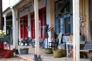
Tightwad, Missouri
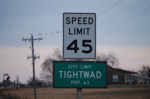

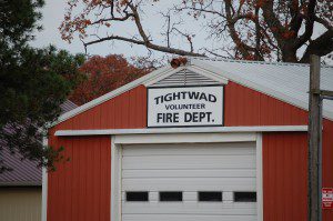
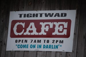
On a trip to Kansas City back in November 2011, I returned via some back roads in south central Missouri. My main destination of choice was Tightwad, Missouri. This is an unincorporated town of about 65 or 70 people. The village’s unusual name is said to stem from an episode in which a store owner cheated a customer, who was a postman, by charging him an extra fifty cents for a better watermelon. Some sources claim the transaction involved a rooster rather than a watermelon. However, there is really nothing definitive. Nonetheless, the town is fun. Perhaps the biggest point of excitement was the Tightwad Bank, which at the time was a real bank (their website says that the closed on June 29, 2015 to become Tightwad Financial, Inc. and moved to Overland Park, KS). According to its original website, the bank was founded on September 5, 1900 as Reading State Bank, a Kansas chartered commercial bank. On March 27, 2008 the bank opened a full service branch in Tightwad, MO and changed its name to Tightwad Bank. You can see my 2011 post HERE.
Talent, Oregon
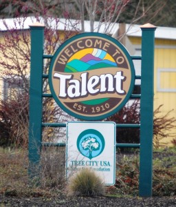
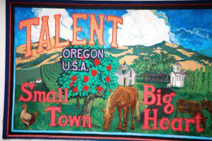
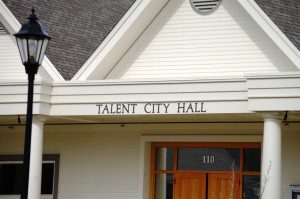
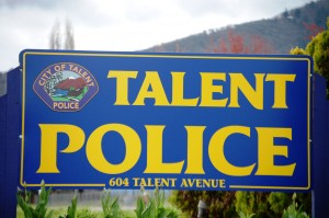
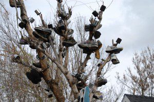
One evening a few years ago we were watching the well known TV Competition show “America’s Got Talent,” when they introduced one of the competitors and indicated he was from a place called Talent, Oregon. I knew then that I had to find a way to that town! In April 2012 I had that opportunity while on a business trip to southern Oregon. Called “The City of Talent“, I am not sure how much talent there actually is here. With a Talent Police Department, a Talent City Hall and even a unique “Shoe Tree,” it is certainly a unique place to go to find some Talent. See my full post about Talent HERE.
Toad Suck, Arkansas
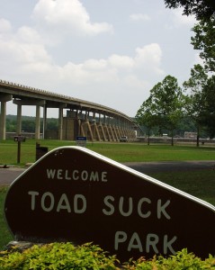
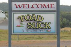
On a road trip to Texas and Arkansas in 2007, we wound our way from Memphis into Arkansas and found a place called Toad Suck (after already visiting Booger Holler – see the B Towns post). Like many odd named communities, Toad Suck has a small population.
According to a local website, the town got its name as follows:
“What does “Toad Suck” mean anyway? Well, the answer is quite simple… Long ago, steamboats traveled the Arkansas River when the water was at the right depth. When it wasn’t, the captains and their crew tied up to wait where the Toad Suck Lock and Dam now spans the river. While they waited, they refreshed themselves at the local tavern there, to the dismay of the folks living nearby, who said: “They suck on the bottle ’til they swell up like toads.” Hence, the name Toad Suck. The tavern is long gone, but the legend and fun live on at Toad Suck Daze”
Check out my post of the entire 2007 trip including our visit to Toad Suck HERE.
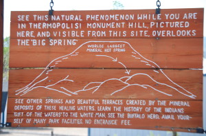
Thermopolis, Wyoming
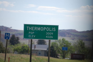
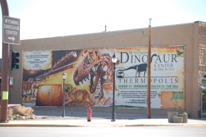
I first visited Thermopolis, Wyoming in 1972. As a 16 year old, I was disenchanted with things at home in Bozeman, Montana and decided to “run away” from home. I hitchhiked my way from Bozeman to West Yellowstone, where I helped a family move things into a truck. They gave me a ride as far as Thermopolis, where I continued on through Wyoming’s Wind River Canyon, riding with a nice Native American lady, who got me into southern Wyoming. I eventually caught my final ride into Denver, where we used to live. Obviously, I got in trouble and returned back to Bozeman.
I again found myself in Thermopolis in the summer of 2014. This town is home to the world’s largest mineral hot springs and the Wyoming Dinosaur Center. From the south Thermopolis is the gateway to Yellowstone Country, and coming from the north it is the gateway to the Wind River Canyon. See my full trip from Cody to Carhenge via Thermopolis HERE.
Teton Valley and Tetonia, Idaho

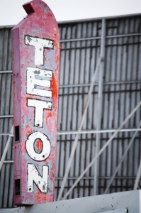

In 2013 I was blessed to make 2 trips to Rexburg, Idaho for work. During those times I made it a point to visit the Grand Tetons from different angles. One of the wonderful places to do this was in the Teton Valley and from Tetonia. The views are amazing and the mountains are splendid. Check out the entire trip post HERE.
Tuba City, Arizona
As I have noted in other posts on this blog, in the 1980s I was a tour guide for Nava-Hopi Tours in Flagstaff. As part of my work I took may tourists on excursions into Navajo and Hopi country. Heading north on US Highway 89 out of Flagstaff and then catching US Highway 160 east, the first major town is Tuba City. Next to Flagstaff, it is the second largest city in Coconino County (which in land area is the second largest county in the United States) and is located on the Navajo Reservation. Continuing east on US 160 the drive eventually gets you to Kayenta, the gateway to Monument Valley. Instead, take AZ 264 south and you head towards the three mesas of the Hopi Reservation. In fact, the name of the town honors Tuuvi, a Hopi headman from Oraibi who converted to Mormonism. The Navajo name for Tuba City, Tó Naneesdizí translates as “tangled waters”, which probably refers to the many below-ground springs that are the source of several reservoirs.
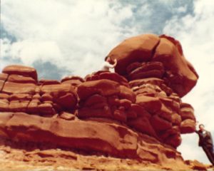
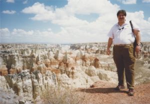
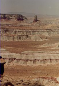
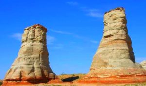
Tuba City is also kind of the gateway for a spectacular canyon known as Coal Mine Canyon, which is accessible about 15 miles away on AZ 264 on the way to the Hopi Reservation. I have literally visited there a couple of hundred times. The canyon is one of many remote, little-visited sites in the Southwest where the main interest comes from the detail of the rock – the colors, forms and textures of the eroded sandstone – rather than the large scale appeal of such grand places as Zion and Monument Valley. Coal Mine Canyon is first sighted about 15 miles from Tuba City, and the usual viewing area is reached by a half mile drive along a dirt track – narrow and bumpy but fine for all vehicles – that leaves highway 264 between mileposts 336 and 337. This track leads to a new-looking 2 story residence, but the canyon rim is a little way to the right, at the end of a side track that passes an isolated windmill and water tank, ending at a parking area next to a rather forlorn picnic spot consisting of a few concrete tables & chairs surrounded by bare red earth within a fenced enclosure.
Tornado, West Virginia

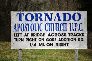
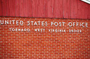
In 2012 I made another road trip to North Carolina and took a side road through West Virginia for the sole purpose of driving through a Hurricane and a Tornado. Hurricane is a bit west of Charleston, WV. Once there, take US Highway 60 southeast and about 16 miles down the road you can drive through Tornado. Officially, Tornado is recognized as Upper Falls, WV. But there are still signs for Tornado. You can see my trip report about my visit to these two places HERE.
Tavistock, Ontario
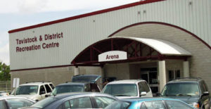


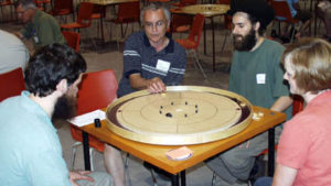
During my 2008 time in Ontario, I was invited to the 10th Annual World Crokinole Championships by then Tavistock Mayor Don McKay, one of the officials at that year’s event. I was greeted by Mayor McKay and also met Tavistock Gazette Editor Bill Gladding. Both were gracious enough to introduce me to this game. The championships are held in this small town as this is where the game was apparently invented in the 1870s. Crokinole (pronounced croak-i-knoll) is an action board game with elements of shuffleboard and curling reduced to table-top size. Players take turns shooting discs across the circular playing surface, trying to have their discs land in the higher-scoring regions of the board, while also attempting to knock away opposing discs. Historically, the game of Crokinole got its start near Tavistock. According to the Crokinole website, “the earliest known Crokinole board was made in 1876 in Perth County, Ontario, Canada. Several other home-made boards of southwestern Ontario origin. You can see my complete report of this June 2008 HERE.
Tomahawk, Wisconsin
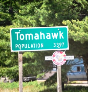
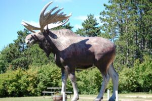
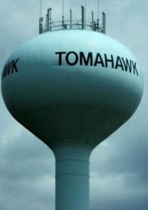
The town of Tomahawk, Wisconsin is located on US Highway 51. We ventured into this colorful town during a 2012 visit to Wisconsin. We had just finished visiting Jurustic Park in Marshfield (see the M Towns Post) and were on the way to Rhinelander (in my R Towns post). Tomahawk has a nice big Moose, a BBQ Place called the Butt Hutt and a lovely Eagle sculpture in the downtown area. Read about the entire trip HERE.
Tripp, South Dakota
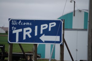
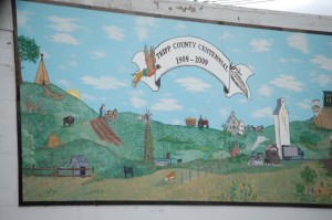

Tripp, South Dakota really offer s very little, but it has a great name for a Road Tripper!! Its all in the Tripp right? Located on South Dakota’s Oyate Trail, which basically follows US Highway 18 across the state. It is between the town of Menno to the east and the lovely Lake Andes to the east. See more about the Oyate Trail Drive HERE.
Tunica, Mississippi
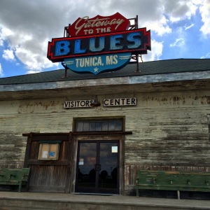
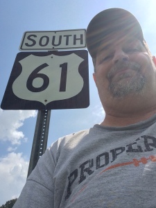
The summer of 2014 was a great travel year for me. I made four big trips, one of which was to Galveston, Texas via US Highway 61, the Blues Highway in Mississippi. If approaching from Memphis, then one of the first stops worth making along the highway is in Tunica. Tunica is huge resort town with a number of hotels and casinos. But it is also home to the Gateway to the Blues Visitors Center. The Visitors Center is built in a rustic train depot, circa 1895. It is filled with guitars, maps, souvenirs, etc. Definitely worth a stop. See the report on my first leg along the Mississippi Blues Highway HERE.
Tioga, Texas (Honorable Mention)
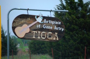
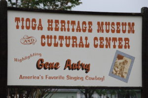
Tioga is a small town in Texas near Sherman and Denison on US Highway 377. It is the birthplace of country music legend and former California Angels owner Gene Autry.
Ten Sleep, Wyoming (Honorable Mention)
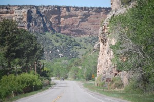

OK. If you found a town named Ten Sleep, wouldn’t you include it in your post? This town is located near Ten Sleep Canyon which is on US Highway 16. It is located in the Big Horn Basin in the western foothills of the Big Horn Mountains, about 26 miles east of Worland and 59 miles west of Buffalo. I drove through here in 2013 on my way from Idaho to Dallas. I left Gillette, went through Buffalo and eventually made may way into Worland. See my full trip post HERE.
Torch, Ohio (Honorable Mention)
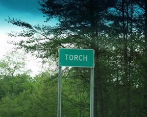
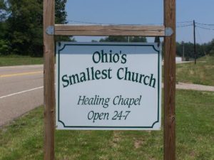
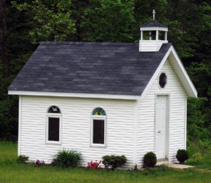
Finally, there is the small blink your eyes and you’ll miss it place along the Ohio River known as Torch, Ohio. Torch is not too far from Coolville, OH (see my C Towns post). (Ironically, the first town north of Coolville on Ohio 144 is called Frost…I did not go there). I could not find anything to provide information as to how Torch got its name. As for the little chapel in Torch, I did some research and came to find that it was built by Lloyd Middleton of Coolville. The non-denominational small chapel (its only 10 ft. by 14 ft.) is open 24/7 and anyone can go in to pray and seek respite. A more detailed writeup of the church’s history and the Ohio River drive can be seen HERE.
Did You Miss My Other A to Z Challenge Posts? Click on a letter below to see the others.
A B C D E F G H I J K L M N O P Q R S T U V W X Y Z
Learn More About the A to Z Challenge and visit hundreds of other participating blogs (click logo below)
![A2Z-BADGE [2016]](http://<a href="http://www.a-to-zchallenge.com" target="_blank"><img src="http://i1139.photobucket.com/albums/n547/Jeremy-iZombie/A2Z-BADGE%202016-smaller_zpslstazvib.jpg" title="Blogging from A to Z April Challenge" /></a>)
I was a caregiver to a child of parents from Tightwad. I always chuckled when payday came and I was handed a check from that bank 🙂 Great post! Native Missourian,
Stephanie Finnell
@randallbychance from
Katy Trail Creations
Stephanies Stuff
Some great little towns there. I’ve been to a few like Ten Sleep and Thermopolis. I’ve been through Hurricane, but don’t recall Tornado.
Check out my previous towns and the rest of the alphabet and you’ll find other places you may have been
[…] B C D E F G H I J K L M N O P Q R S T U V W X Y […]
[…] B C D E F G H I J K L M N O P Q R S T U V W X Y […]