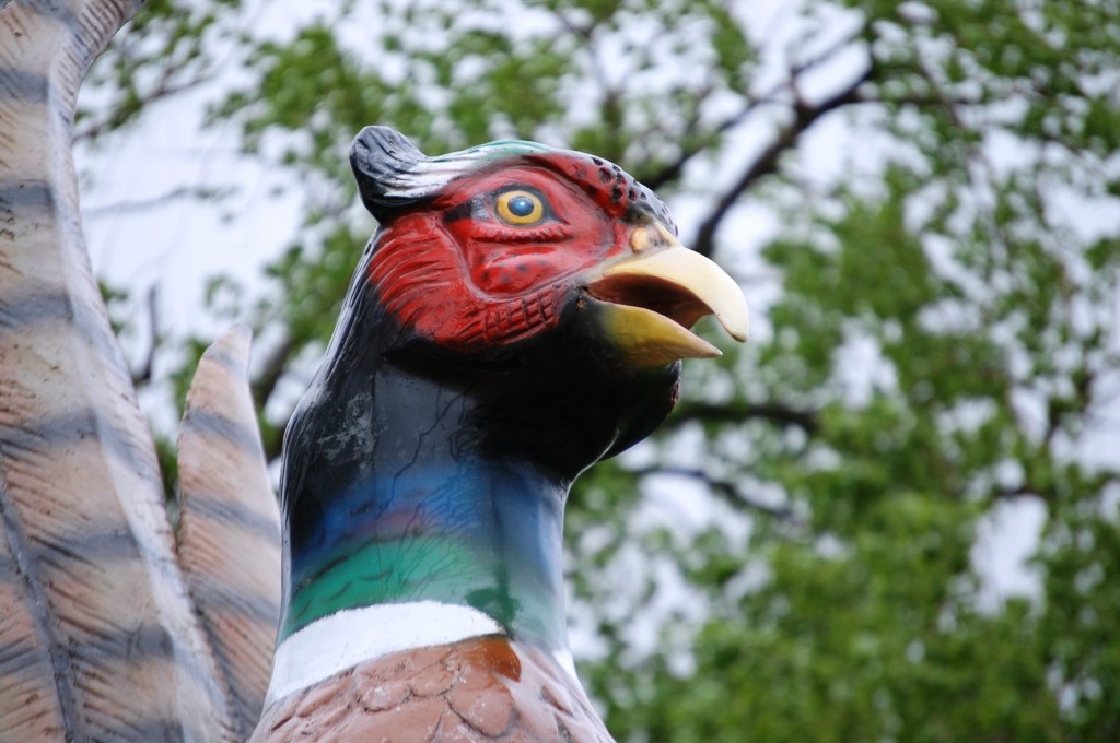
 Land of the Pheasants – southern South Dakota[/caption]
In early April 2013 I had the opportunity to drive across the Hi-Line (US Route 2) in Northern Montana and then made our way to South Dakota to see Mt. Rushmore and all the across South Dakota to Mitchell and the Corn Palace. With another work trip to Idaho, I took a different route and, similar to the Hi-Line Drive, I mainly took US Route 18 (also known as the Oyate Trail) as it crosses most of South Dakota. It goes through many small and unique towns.
[caption id="attachment_4002" align="aligncenter" width="201"]
Land of the Pheasants – southern South Dakota[/caption]
In early April 2013 I had the opportunity to drive across the Hi-Line (US Route 2) in Northern Montana and then made our way to South Dakota to see Mt. Rushmore and all the across South Dakota to Mitchell and the Corn Palace. With another work trip to Idaho, I took a different route and, similar to the Hi-Line Drive, I mainly took US Route 18 (also known as the Oyate Trail) as it crosses most of South Dakota. It goes through many small and unique towns.
[caption id="attachment_4002" align="aligncenter" width="201"]![]() Oyate Trail[/caption]
The Oyate Trail is a 388 mile route that generally follows SD 50 and US Route 18 across southern South Dakota. The name is derived from the Lakota word “Oyate”, which means “a people or a nation” and “Ochanku”, which is Lakota for “trail.” Thus, the trail of nations, initially meaning the trail to the various Lakota Nations — the Yankton, the Rosebud and Pine Ridge Sioux nations. But, the meaning is even more complex with the coming of the Europeans and the mixture of their cultures along the trail.
Oyate Trail[/caption]
The Oyate Trail is a 388 mile route that generally follows SD 50 and US Route 18 across southern South Dakota. The name is derived from the Lakota word “Oyate”, which means “a people or a nation” and “Ochanku”, which is Lakota for “trail.” Thus, the trail of nations, initially meaning the trail to the various Lakota Nations — the Yankton, the Rosebud and Pine Ridge Sioux nations. But, the meaning is even more complex with the coming of the Europeans and the mixture of their cultures along the trail.
Oyate Trail across South Dakota
[caption id="attachment_3828" align="aligncenter" width="300"]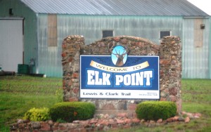 Elk Point, SD – “Where South Dakota Begins”[/caption]
I started off in Kentucky on May 31 and spent the evening near Omaha, NE. On June 1 I headed north towards South Dakota, entering South Dakota in Sioux City on I-29. I took the freeway into the small town of Elk Point, another of the many places that Lewis and Clark had visited. They made camp nearby the area in August 1804.
[caption id="attachment_3829" align="aligncenter" width="199"]
Elk Point, SD – “Where South Dakota Begins”[/caption]
I started off in Kentucky on May 31 and spent the evening near Omaha, NE. On June 1 I headed north towards South Dakota, entering South Dakota in Sioux City on I-29. I took the freeway into the small town of Elk Point, another of the many places that Lewis and Clark had visited. They made camp nearby the area in August 1804.
[caption id="attachment_3829" align="aligncenter" width="199"]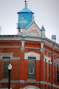 Downtown Elk Point, South Dakota[/caption]
My main stop in Elk Point was at Edgar’s Soda Fountain, a throwback to the good old days. Originally opened in Centerville in 1906 in a drug store, the soda fountain was taken out of the drug store in the 1960s. It eventually was rediscovered and rebuilt by the granddaughter of the drug store owner. They have even brought out the old manuals and have some concoctions directly from those manuals, such as The Standard Manual of Soda and Other Beverages.
[caption id="attachment_3830" align="aligncenter" width="199"]
Downtown Elk Point, South Dakota[/caption]
My main stop in Elk Point was at Edgar’s Soda Fountain, a throwback to the good old days. Originally opened in Centerville in 1906 in a drug store, the soda fountain was taken out of the drug store in the 1960s. It eventually was rediscovered and rebuilt by the granddaughter of the drug store owner. They have even brought out the old manuals and have some concoctions directly from those manuals, such as The Standard Manual of Soda and Other Beverages.
[caption id="attachment_3830" align="aligncenter" width="199"]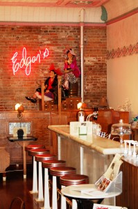 Edgar’s Soda Fountain Bar[/caption]
Owner Barb Wurtz was there and the staff was ultra friendly. They had an old-fashioned candy case, nice neon, original wooden booths and bar seating. Its a great place to take a quick break off the road.
[caption id="attachment_3831" align="aligncenter" width="199"]
Edgar’s Soda Fountain Bar[/caption]
Owner Barb Wurtz was there and the staff was ultra friendly. They had an old-fashioned candy case, nice neon, original wooden booths and bar seating. Its a great place to take a quick break off the road.
[caption id="attachment_3831" align="aligncenter" width="199"]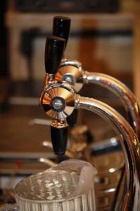 The Fountain[/caption]
[caption id="attachment_3834" align="aligncenter" width="300"]
The Fountain[/caption]
[caption id="attachment_3834" align="aligncenter" width="300"]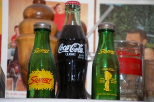 Old Soda Bottles[/caption]
[caption id="attachment_3835" align="aligncenter" width="300"]
Old Soda Bottles[/caption]
[caption id="attachment_3835" align="aligncenter" width="300"]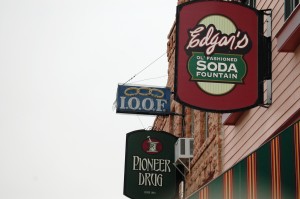 Outdoor Signage at Edgar’s[/caption]
[caption id="attachment_3998" align="aligncenter" width="300"]
Outdoor Signage at Edgar’s[/caption]
[caption id="attachment_3998" align="aligncenter" width="300"]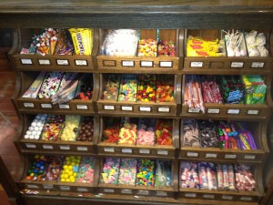 Candy Counter at Edgar’s[/caption]
I also wanted to drop by Edgar’s with my good friend and amazing guitarist Edgar Cruz in mind. So, “Welcome to Edgar’s!”
[caption id="attachment_3997" align="aligncenter" width="300"]
Candy Counter at Edgar’s[/caption]
I also wanted to drop by Edgar’s with my good friend and amazing guitarist Edgar Cruz in mind. So, “Welcome to Edgar’s!”
[caption id="attachment_3997" align="aligncenter" width="300"]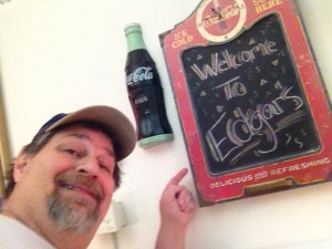 Welcome to Edgar’s[/caption]
After consulting with the great staff at Edgar’s, I determined to make my way along US Route 18 (the Oyate Trail), which would take me across the lush prairies of southern South Dakota and into some small and unique towns. After visiting the Lewis and Clark Campsite monument n Elk Point, I headed north on I 29 to Exit 47 near Beresford and then west to Viborg. The Oyate Trail actually starts in Vermillion, SD, just NW of Elk Point, but I wanted to hit Viborg first.
[caption id="attachment_3837" align="aligncenter" width="300"]
Welcome to Edgar’s[/caption]
After consulting with the great staff at Edgar’s, I determined to make my way along US Route 18 (the Oyate Trail), which would take me across the lush prairies of southern South Dakota and into some small and unique towns. After visiting the Lewis and Clark Campsite monument n Elk Point, I headed north on I 29 to Exit 47 near Beresford and then west to Viborg. The Oyate Trail actually starts in Vermillion, SD, just NW of Elk Point, but I wanted to hit Viborg first.
[caption id="attachment_3837" align="aligncenter" width="300"]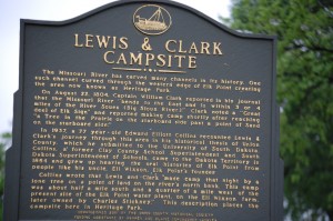 Lewis and Clark Campsite – Elk Point, SD[/caption]
After leaving I-29, I headed west on SD 46 to Viborg, South Dakota.
[caption id="attachment_3841" align="aligncenter" width="300"]
Lewis and Clark Campsite – Elk Point, SD[/caption]
After leaving I-29, I headed west on SD 46 to Viborg, South Dakota.
[caption id="attachment_3841" align="aligncenter" width="300"]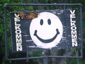 Velkommen to Viborg[/caption]
Viborg is a town of around 700 and was settled by Danish immigrants in the 1860s. The town is named for Viborg in Denmark. The town was originally named Daneville, but with the coming of the railroad in the 1890s, the residents had to move a bit north so they could be along the railroad. Thus Viborg was born and was finally incorporated in August 1903.
[caption id="attachment_3842" align="aligncenter" width="300"]
Velkommen to Viborg[/caption]
Viborg is a town of around 700 and was settled by Danish immigrants in the 1860s. The town is named for Viborg in Denmark. The town was originally named Daneville, but with the coming of the railroad in the 1890s, the residents had to move a bit north so they could be along the railroad. Thus Viborg was born and was finally incorporated in August 1903.
[caption id="attachment_3842" align="aligncenter" width="300"]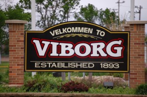 Welcome to Viborg[/caption]
[caption id="attachment_3843" align="aligncenter" width="300"]
Welcome to Viborg[/caption]
[caption id="attachment_3843" align="aligncenter" width="300"]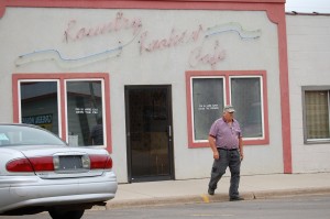 Kountry Kookin’ Cafe – Viborg, SD[/caption]
As I drive through town I got glimpses of the culture. The Kountry Kookin’ Cafe, with its built in neon sign above the door, gave me cause for chuckle. The window on the right says “Dis is vare Sven loves the dinners” and the window on the left says “Dis is vare Ole gets the pie.” Had there been time, it could have been “Dis is vare Sumoflam gets the lunch!”
[caption id="attachment_3844" align="aligncenter" width="300"]
Kountry Kookin’ Cafe – Viborg, SD[/caption]
As I drive through town I got glimpses of the culture. The Kountry Kookin’ Cafe, with its built in neon sign above the door, gave me cause for chuckle. The window on the right says “Dis is vare Sven loves the dinners” and the window on the left says “Dis is vare Ole gets the pie.” Had there been time, it could have been “Dis is vare Sumoflam gets the lunch!”
[caption id="attachment_3844" align="aligncenter" width="300"]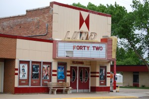 Lund Theater in Viborg[/caption]
Like many small towns, there are the old fashioned theaters that thrived in the 1950s and 1960s. But these are a dying breed so I try to get shots of them when I go through these small towns.
[caption id="attachment_3840" align="aligncenter" width="199"]
Lund Theater in Viborg[/caption]
Like many small towns, there are the old fashioned theaters that thrived in the 1950s and 1960s. But these are a dying breed so I try to get shots of them when I go through these small towns.
[caption id="attachment_3840" align="aligncenter" width="199"]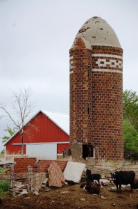 Decorative Glazed Block Grain Silo near Viborg, SD[/caption]
On the outskirts of Viborg I came across this unusual, yet decorative grain silo. As I drive the back roads of this country, whether in Tennessee, Texas, Wisconsin or elsewhere, silos are a common site. Yet, I don’t recall ever seeing brick silos like this one, nor do I recall the decorative nature. After a bit of internet research (thank you Google!!) I have learned that these are Glazed Block Silos. They are apparently very common in parts of Minnesota, Wisconsin, North Dakota and South Dakota. I am assuming that they are of Scandinavian origin, though I have not yet found anything definitive.
[caption id="attachment_3839" align="aligncenter" width="300"]
Decorative Glazed Block Grain Silo near Viborg, SD[/caption]
On the outskirts of Viborg I came across this unusual, yet decorative grain silo. As I drive the back roads of this country, whether in Tennessee, Texas, Wisconsin or elsewhere, silos are a common site. Yet, I don’t recall ever seeing brick silos like this one, nor do I recall the decorative nature. After a bit of internet research (thank you Google!!) I have learned that these are Glazed Block Silos. They are apparently very common in parts of Minnesota, Wisconsin, North Dakota and South Dakota. I am assuming that they are of Scandinavian origin, though I have not yet found anything definitive.
[caption id="attachment_3839" align="aligncenter" width="300"]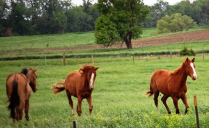 Horses Frolicking near Viborg, SD[/caption]
Living in Lexington I see plenty of horses. But, I couldn’t help but notice this happy trio in the lush prairie grasses near Viborg. I sat and watched them for a few minutes as they frolicked and played.
[caption id="attachment_3838" align="aligncenter" width="300"]
Horses Frolicking near Viborg, SD[/caption]
Living in Lexington I see plenty of horses. But, I couldn’t help but notice this happy trio in the lush prairie grasses near Viborg. I sat and watched them for a few minutes as they frolicked and played.
[caption id="attachment_3838" align="aligncenter" width="300"]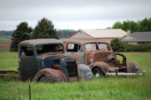 Old remnants of yesteryear near Viborg — I love old cars![/caption]
From Viborg I headed straight north on SD 19 past Swan Lake to US 18 and began my trek across the state.
[caption id="attachment_3845" align="aligncenter" width="300"]
Old remnants of yesteryear near Viborg — I love old cars![/caption]
From Viborg I headed straight north on SD 19 past Swan Lake to US 18 and began my trek across the state.
[caption id="attachment_3845" align="aligncenter" width="300"]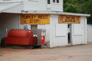 Turkey Ridge Store – Hurley, SD[/caption]
[caption id="attachment_4003" align="aligncenter" width="300"]
Turkey Ridge Store – Hurley, SD[/caption]
[caption id="attachment_4003" align="aligncenter" width="300"] Meridian Corner at US 18 and US 81 junction – Freeman, SD[/caption]
I passed the two establishments along the road. Both were basically in the middle of nowhere. Meridian Corner has a fairly active Facebook Page. They are apparently quite popular and have T-shirts, etc.
[caption id="attachment_3846" align="aligncenter" width="300"]
Meridian Corner at US 18 and US 81 junction – Freeman, SD[/caption]
I passed the two establishments along the road. Both were basically in the middle of nowhere. Meridian Corner has a fairly active Facebook Page. They are apparently quite popular and have T-shirts, etc.
[caption id="attachment_3846" align="aligncenter" width="300"]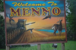 Menno, SD[/caption]
[caption id="attachment_3847" align="aligncenter" width="300"]
Menno, SD[/caption]
[caption id="attachment_3847" align="aligncenter" width="300"] Menno, South Dakota[/caption]
I rolled into Menno, SD next. Menno was settled by German-Russian immigrants around 1874. Continuing west my next stop was in Tripp, SD. This was the first Tripp I have experienced on my many trips!! The town slogan “Easy to Find, Hard to Leave”. For me, its as my friend Antsy McClain says “Its All in the Trip”.
[caption id="attachment_3848" align="aligncenter" width="300"]
Menno, South Dakota[/caption]
I rolled into Menno, SD next. Menno was settled by German-Russian immigrants around 1874. Continuing west my next stop was in Tripp, SD. This was the first Tripp I have experienced on my many trips!! The town slogan “Easy to Find, Hard to Leave”. For me, its as my friend Antsy McClain says “Its All in the Trip”.
[caption id="attachment_3848" align="aligncenter" width="300"]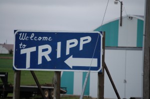 Welcome to Tripp, South Dakota[/caption]
Tripp recently became a destination for a group of Amish families that moved from Wisconsin in 2010. This, of course, brings the need for a blacksmith. The name on the barn reminded me of the Amish, so I checked and indeed, as the link above explains, the first Amish in South Dakota are in this area.
[caption id="attachment_3849" align="aligncenter" width="300"]
Welcome to Tripp, South Dakota[/caption]
Tripp recently became a destination for a group of Amish families that moved from Wisconsin in 2010. This, of course, brings the need for a blacksmith. The name on the barn reminded me of the Amish, so I checked and indeed, as the link above explains, the first Amish in South Dakota are in this area.
[caption id="attachment_3849" align="aligncenter" width="300"]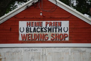 Heine Prien – Blacksmith – Tripp, SD[/caption]
[caption id="attachment_3850" align="aligncenter" width="300"]
Heine Prien – Blacksmith – Tripp, SD[/caption]
[caption id="attachment_3850" align="aligncenter" width="300"]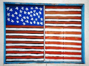 Flag painted in Window – Tripp, SD[/caption]
[caption id="attachment_3852" align="aligncenter" width="300"]
Flag painted in Window – Tripp, SD[/caption]
[caption id="attachment_3852" align="aligncenter" width="300"] Old Neon Sign – Tripp, SD[/caption]
[caption id="attachment_3853" align="aligncenter" width="300"]
Old Neon Sign – Tripp, SD[/caption]
[caption id="attachment_3853" align="aligncenter" width="300"] My version of a John Deere ad – outside of Tripp, SD[/caption]
I continued west on US 18 passing by farmland and a few trees. I found one set of trees that struck me…these were near the junction with US 281, where US 18 heads due south towards Ravinia, SD.
[caption id="attachment_3854" align="aligncenter" width="640"]
My version of a John Deere ad – outside of Tripp, SD[/caption]
I continued west on US 18 passing by farmland and a few trees. I found one set of trees that struck me…these were near the junction with US 281, where US 18 heads due south towards Ravinia, SD.
[caption id="attachment_3854" align="aligncenter" width="640"]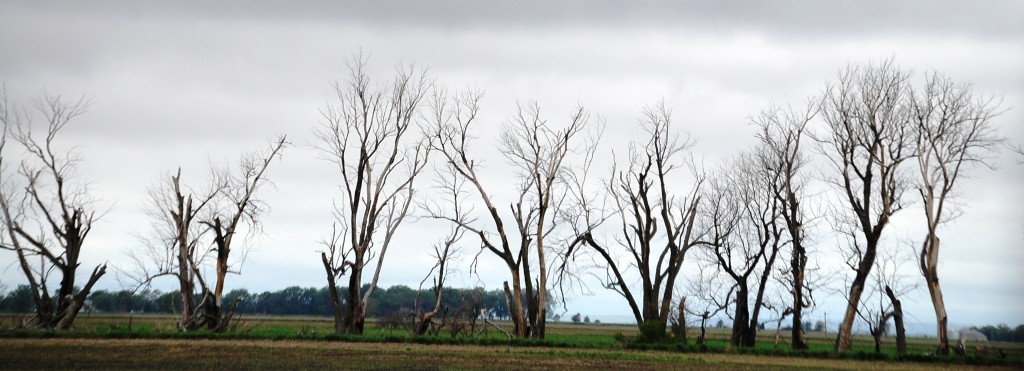 Trees on US 18 near US 281[/caption]
[caption id="attachment_3855" align="aligncenter" width="300"]
Trees on US 18 near US 281[/caption]
[caption id="attachment_3855" align="aligncenter" width="300"]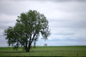 Farmland near Ravinia, SD[/caption]
US 18/US 281 again heads west near the base of Lake Andes, which is a National Wildlife Refuge. As I drive along the southern border of the lake, I saw a huge flock of white birds. From my viewpoint I thought they were swans, but I decided to take a closer look so I took a drive into the small park just before getting to the town of Lake Andes, SD. I was thrilled as I got closer and discovered it was a huge flock of pelicans!!
[caption id="attachment_3857" align="aligncenter" width="640"]
Farmland near Ravinia, SD[/caption]
US 18/US 281 again heads west near the base of Lake Andes, which is a National Wildlife Refuge. As I drive along the southern border of the lake, I saw a huge flock of white birds. From my viewpoint I thought they were swans, but I decided to take a closer look so I took a drive into the small park just before getting to the town of Lake Andes, SD. I was thrilled as I got closer and discovered it was a huge flock of pelicans!!
[caption id="attachment_3857" align="aligncenter" width="640"]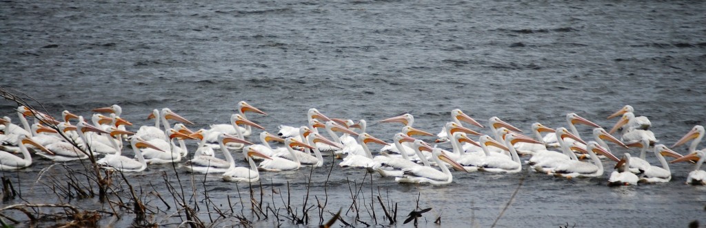 Pelicans in Lake Andes, SD[/caption]
[caption id="attachment_3859" align="aligncenter" width="300"]
Pelicans in Lake Andes, SD[/caption]
[caption id="attachment_3859" align="aligncenter" width="300"]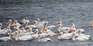 More Pelicans – Lake Andes, SD[/caption]
[caption id="attachment_3858" align="aligncenter" width="300"]
More Pelicans – Lake Andes, SD[/caption]
[caption id="attachment_3858" align="aligncenter" width="300"]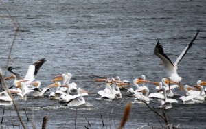 Pelicans taking flight – Lake Andes, SD[/caption]
Seeing the Pelicans was a real thrill for me as these were birds that I have never had a close encounter with. While at the lake, I also saw some beautiful purple wildflowers.
[caption id="attachment_3860" align="aligncenter" width="285"]
Pelicans taking flight – Lake Andes, SD[/caption]
Seeing the Pelicans was a real thrill for me as these were birds that I have never had a close encounter with. While at the lake, I also saw some beautiful purple wildflowers.
[caption id="attachment_3860" align="aligncenter" width="285"]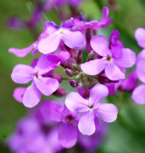 Purple Dame’s Rocket Wildflowers near Lake Andes, SD[/caption]
From Lake Andes I continued south on US 18/281 to cross over the dam at the Randall Creek Recreation Area. At the top of the hill past the dam I had an excellent view of the Old Fort Randall Cemetery.
[caption id="attachment_3863" align="aligncenter" width="300"]
Purple Dame’s Rocket Wildflowers near Lake Andes, SD[/caption]
From Lake Andes I continued south on US 18/281 to cross over the dam at the Randall Creek Recreation Area. At the top of the hill past the dam I had an excellent view of the Old Fort Randall Cemetery.
[caption id="attachment_3863" align="aligncenter" width="300"]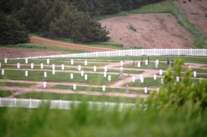 Old Fort Randall Cemetery[/caption]
US 18 continued west, then southwest for a while and then began heading northwest again towards the town of Bonesteel.
[caption id="attachment_3864" align="aligncenter" width="300"]
Old Fort Randall Cemetery[/caption]
US 18 continued west, then southwest for a while and then began heading northwest again towards the town of Bonesteel.
[caption id="attachment_3864" align="aligncenter" width="300"]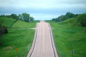 The road goes on forever – US 18 in southern South Dakota[/caption]
[caption id="attachment_3865" align="aligncenter" width="300"]
The road goes on forever – US 18 in southern South Dakota[/caption]
[caption id="attachment_3865" align="aligncenter" width="300"]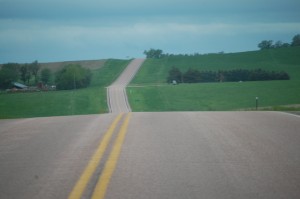 More winding road in South Dakota[/caption]
The town of Bonesteel was basically the first town of many on the actual Oyate Trail that I would hit on this drive. Bonesteel has an interesting name, named after H.E. Bonesteel and hasjust about 300 people.
[caption id="attachment_3866" align="aligncenter" width="300"]
More winding road in South Dakota[/caption]
The town of Bonesteel was basically the first town of many on the actual Oyate Trail that I would hit on this drive. Bonesteel has an interesting name, named after H.E. Bonesteel and hasjust about 300 people.
[caption id="attachment_3866" align="aligncenter" width="300"]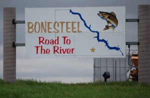 Bonesteel Welcome Sign[/caption]
[caption id="attachment_3867" align="aligncenter" width="300"]
Bonesteel Welcome Sign[/caption]
[caption id="attachment_3867" align="aligncenter" width="300"]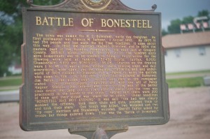 Battle of Bonesteel Commenmorative Sign[/caption]
[caption id="attachment_3869" align="aligncenter" width="300"]
Battle of Bonesteel Commenmorative Sign[/caption]
[caption id="attachment_3869" align="aligncenter" width="300"]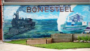 Bonesteel Mural[/caption]
The railroad first made its way into Bonesteel in 1902. there were a limited number of registrations for land ownership and eventually many of the prospective homesteaders fought leading to what was called “the Battle of Bonesteel.”
[caption id="attachment_3870" align="aligncenter" width="300"]
Bonesteel Mural[/caption]
The railroad first made its way into Bonesteel in 1902. there were a limited number of registrations for land ownership and eventually many of the prospective homesteaders fought leading to what was called “the Battle of Bonesteel.”
[caption id="attachment_3870" align="aligncenter" width="300"]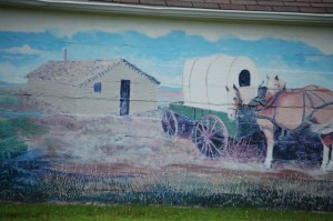 Bonesteel Mural[/caption]
[caption id="attachment_3871" align="aligncenter" width="300"]
Bonesteel Mural[/caption]
[caption id="attachment_3871" align="aligncenter" width="300"]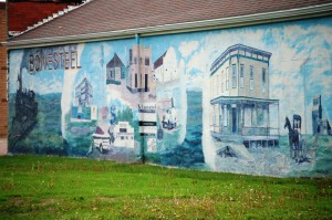 Another Bonesteel Mural[/caption]
On the outskirts of town is a small little restaurant. Great name…
[caption id="attachment_3873" align="aligncenter" width="199"]
Another Bonesteel Mural[/caption]
On the outskirts of town is a small little restaurant. Great name…
[caption id="attachment_3873" align="aligncenter" width="199"]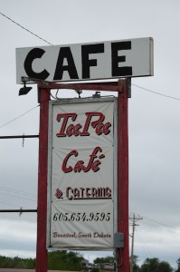 TeePee Cafe – Bonesteel, SD[/caption]
The next town on the trail was Burke, SD, another town with about 600 people. As I approached town I ran into a place called Rooster Tales Hunting Service. They had a unique sign and even a patriotic hay bale! Turns out that they have a Pheasant hunting service.
[caption id="attachment_3878" align="aligncenter" width="199"]
TeePee Cafe – Bonesteel, SD[/caption]
The next town on the trail was Burke, SD, another town with about 600 people. As I approached town I ran into a place called Rooster Tales Hunting Service. They had a unique sign and even a patriotic hay bale! Turns out that they have a Pheasant hunting service.
[caption id="attachment_3878" align="aligncenter" width="199"]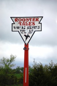 Rooster Tales Hunting Service – Burke, SD[/caption]
[caption id="attachment_3877" align="aligncenter" width="199"]
Rooster Tales Hunting Service – Burke, SD[/caption]
[caption id="attachment_3877" align="aligncenter" width="199"]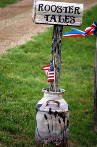 Rooster Tales Mailbox in a milk can[/caption]
[caption id="attachment_3876" align="aligncenter" width="300"]
Rooster Tales Mailbox in a milk can[/caption]
[caption id="attachment_3876" align="aligncenter" width="300"]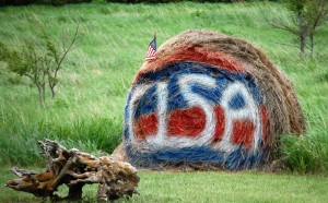 Patriotic Hay Bale at Rooster Tales[/caption]
This part of South Dakota is considered the pheasant capital of the U.S. (including a number of towns competing for the title). So, despite the small towns, there are hotels and accommodations for pheasant hunting enthusiasts.
[caption id="attachment_3880" align="aligncenter" width="300"]
Patriotic Hay Bale at Rooster Tales[/caption]
This part of South Dakota is considered the pheasant capital of the U.S. (including a number of towns competing for the title). So, despite the small towns, there are hotels and accommodations for pheasant hunting enthusiasts.
[caption id="attachment_3880" align="aligncenter" width="300"]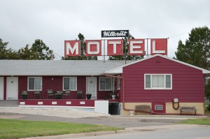 Old style motel – Hillcrest Motel – Burke, SD[/caption]
[caption id="attachment_3879" align="aligncenter" width="199"]
Old style motel – Hillcrest Motel – Burke, SD[/caption]
[caption id="attachment_3879" align="aligncenter" width="199"]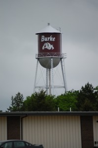 Burke, SD Water Tower[/caption]
Despite its size, Burke is also home to the Burke Stampede Rodeo, supposedly the largest amateur rodeo in the Midwest.
[caption id="attachment_3881" align="aligncenter" width="300"]
Burke, SD Water Tower[/caption]
Despite its size, Burke is also home to the Burke Stampede Rodeo, supposedly the largest amateur rodeo in the Midwest.
[caption id="attachment_3881" align="aligncenter" width="300"]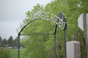 Burke Stampede Rodeo – Burke, SD[/caption]
The next major stop on the road is Gregory, South Dakota. This is in the midst of pheasant country. South Dakota is the pheasant capital of the U.S. and this area of the Oyate Trail is one of the centers of the pheasant hunting world (and, in Gregory there is also a Gorilla or two….)
[caption id="attachment_3888" align="aligncenter" width="300"]
Burke Stampede Rodeo – Burke, SD[/caption]
The next major stop on the road is Gregory, South Dakota. This is in the midst of pheasant country. South Dakota is the pheasant capital of the U.S. and this area of the Oyate Trail is one of the centers of the pheasant hunting world (and, in Gregory there is also a Gorilla or two….)
[caption id="attachment_3888" align="aligncenter" width="300"]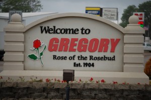 Welcome to Gregory[/caption]
[caption id="attachment_3882" align="aligncenter" width="199"]
Welcome to Gregory[/caption]
[caption id="attachment_3882" align="aligncenter" width="199"]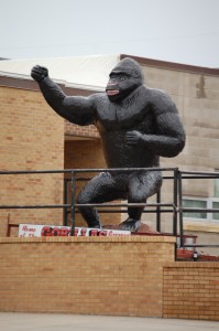 Gregory – Home of the Gorillas[/caption]
[caption id="attachment_3886" align="aligncenter" width="300"]
Gregory – Home of the Gorillas[/caption]
[caption id="attachment_3886" align="aligncenter" width="300"] Gregory Wall Art[/caption]
[caption id="attachment_3884" align="aligncenter" width="300"]
Gregory Wall Art[/caption]
[caption id="attachment_3884" align="aligncenter" width="300"] Mary Bob’s Bar – Gregory, Idaho[/caption]
I got a kick out Mary Bob’s Bar — out in Kentucky we hear of “Jim Bob” all the time, but I have never heard of “Mary Bob.”
[caption id="attachment_3885" align="aligncenter" width="300"]
Mary Bob’s Bar – Gregory, Idaho[/caption]
I got a kick out Mary Bob’s Bar — out in Kentucky we hear of “Jim Bob” all the time, but I have never heard of “Mary Bob.”
[caption id="attachment_3885" align="aligncenter" width="300"]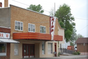 Hipp Theatre – Gregory, SD[/caption]
The Hipp Theatre in Gregory is a community volunteer run theatre, but does show up to date first run movies.
[caption id="attachment_3891" align="aligncenter" width="300"]
Hipp Theatre – Gregory, SD[/caption]
The Hipp Theatre in Gregory is a community volunteer run theatre, but does show up to date first run movies.
[caption id="attachment_3891" align="aligncenter" width="300"]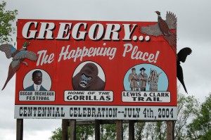 Gregory – The Happening Place[/caption]
Then there is the giant pheasant….
[caption id="attachment_3889" align="aligncenter" width="199"]
Gregory – The Happening Place[/caption]
Then there is the giant pheasant….
[caption id="attachment_3889" align="aligncenter" width="199"]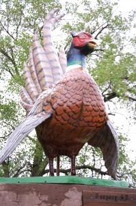 Giant Pheasant – Gregory, SD[/caption]
[caption id="attachment_4011" align="aligncenter" width="225"]
Giant Pheasant – Gregory, SD[/caption]
[caption id="attachment_4011" align="aligncenter" width="225"] Sumoflam and Giant Pheasant[/caption]
Apparently Gregory is “The ground-zero of pheasantdom” according to Fortune Magazine in 1992.
[caption id="attachment_4019" align="aligncenter" width="222"]
Sumoflam and Giant Pheasant[/caption]
Apparently Gregory is “The ground-zero of pheasantdom” according to Fortune Magazine in 1992.
[caption id="attachment_4019" align="aligncenter" width="222"]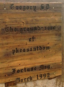 Pheasant Sign – Gregory, SD[/caption]
Next stop was not too far — Dallas, South Dakota
[caption id="attachment_3894" align="aligncenter" width="300"]
Pheasant Sign – Gregory, SD[/caption]
Next stop was not too far — Dallas, South Dakota
[caption id="attachment_3894" align="aligncenter" width="300"]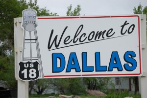 Welcome to Dallas, South Dakota[/caption]
Dallas is a really small town but has some interesting things…
[caption id="attachment_3895" align="aligncenter" width="199"]
Welcome to Dallas, South Dakota[/caption]
Dallas is a really small town but has some interesting things…
[caption id="attachment_3895" align="aligncenter" width="199"]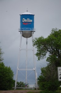 Water tower in Dallas — in the middle of the road[/caption]
[caption id="attachment_3893" align="aligncenter" width="300"]
Water tower in Dallas — in the middle of the road[/caption]
[caption id="attachment_3893" align="aligncenter" width="300"]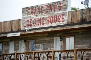 Frank Day’s Lodging House[/caption]
Frank Day’s looks run down, but, apparently it is one of the “happening places” on the Oyate Trail. They have fashioned themselves as an old western-style saloon and also seem to be an attraction for bikers.
[caption id="attachment_3892" align="aligncenter" width="239"]
Frank Day’s Lodging House[/caption]
Frank Day’s looks run down, but, apparently it is one of the “happening places” on the Oyate Trail. They have fashioned themselves as an old western-style saloon and also seem to be an attraction for bikers.
[caption id="attachment_3892" align="aligncenter" width="239"]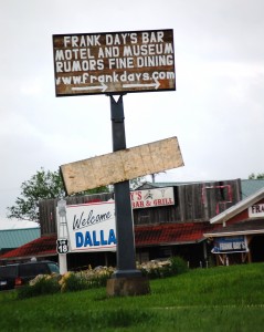 Frank Day’s Signs[/caption]
Moving west on US 18 I finally arrived at one of my “planned destinations.” Those that follow my blogs know that I am always looking for unique town names like Uncertain (TX), Boring (OR), Peculiar (MO), Tightwad (MO), Odd (WV) and more. Well, this town is a real Winner!!! Yes, Winner, South Dakota.
[caption id="attachment_3898" align="aligncenter" width="640"]
Frank Day’s Signs[/caption]
Moving west on US 18 I finally arrived at one of my “planned destinations.” Those that follow my blogs know that I am always looking for unique town names like Uncertain (TX), Boring (OR), Peculiar (MO), Tightwad (MO), Odd (WV) and more. Well, this town is a real Winner!!! Yes, Winner, South Dakota.
[caption id="attachment_3898" align="aligncenter" width="640"] Welcome to Winner, SD – Pheasant Capital of the World[/caption]
Winner was part of the Louisiana Purchase of 1803 and later part of the Dakota Territory, which was established by an act of Congress and a proclamation by President Abraham Lincoln in 1861. Winner was named because it was the “winner” in the struggle to establish a town along the railroad right-of-way when the Chicago North Western began moving west from Dallas, SD in 1909.
[caption id="attachment_3897" align="aligncenter" width="300"]
Welcome to Winner, SD – Pheasant Capital of the World[/caption]
Winner was part of the Louisiana Purchase of 1803 and later part of the Dakota Territory, which was established by an act of Congress and a proclamation by President Abraham Lincoln in 1861. Winner was named because it was the “winner” in the struggle to establish a town along the railroad right-of-way when the Chicago North Western began moving west from Dallas, SD in 1909.
[caption id="attachment_3897" align="aligncenter" width="300"]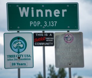 Winner, South Dakota[/caption]
[caption id="attachment_3899" align="aligncenter" width="300"]
Winner, South Dakota[/caption]
[caption id="attachment_3899" align="aligncenter" width="300"]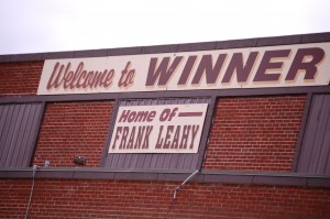 Welcome to Winner – Home of Frank Leahy[/caption]
Frank Leahy was one of Notre Dame’s most famous coaches. He grew up in Winner.
[caption id="attachment_3900" align="aligncenter" width="300"]
Welcome to Winner – Home of Frank Leahy[/caption]
Frank Leahy was one of Notre Dame’s most famous coaches. He grew up in Winner.
[caption id="attachment_3900" align="aligncenter" width="300"]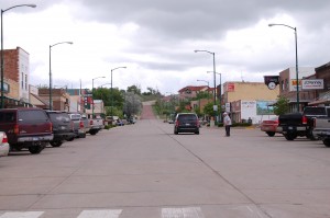 Downtown Winner, SD[/caption]
[caption id="attachment_3901" align="aligncenter" width="300"]
Downtown Winner, SD[/caption]
[caption id="attachment_3901" align="aligncenter" width="300"]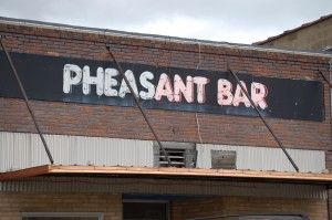 Pheasant Bar, Winner, SD[/caption]
While I was in Winner, I stopped for a drink and a snack at a gas station. I just had to ask…had anyone ever won it big in the lottery in Winner. And, believe it or not, there was indeed a winning ticket sold, and, ironically, the winner’s name was Neal Wanless (awfully close to Winless…). Wanless was a Winner in Winner to the tune of $232 million. He apparently has many friends that frequent the Pheasant Bar.
[caption id="attachment_3903" align="aligncenter" width="300"]
Pheasant Bar, Winner, SD[/caption]
While I was in Winner, I stopped for a drink and a snack at a gas station. I just had to ask…had anyone ever won it big in the lottery in Winner. And, believe it or not, there was indeed a winning ticket sold, and, ironically, the winner’s name was Neal Wanless (awfully close to Winless…). Wanless was a Winner in Winner to the tune of $232 million. He apparently has many friends that frequent the Pheasant Bar.
[caption id="attachment_3903" align="aligncenter" width="300"]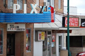 Pix Theatre – Winner, SD[/caption]
Want a winning place to buy groceries? Try this place….
[caption id="attachment_3904" align="aligncenter" width="300"]
Pix Theatre – Winner, SD[/caption]
Want a winning place to buy groceries? Try this place….
[caption id="attachment_3904" align="aligncenter" width="300"]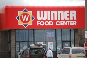 Winner Food Center, Winner, SD[/caption]
[caption id="attachment_3906" align="aligncenter" width="300"]
Winner Food Center, Winner, SD[/caption]
[caption id="attachment_3906" align="aligncenter" width="300"]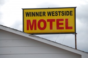 Winner Westside Motel[/caption]
The Motel Parking lot above is home to another Pheasant Statue, as seen below…
[caption id="attachment_3905" align="aligncenter" width="640"]
Winner Westside Motel[/caption]
The Motel Parking lot above is home to another Pheasant Statue, as seen below…
[caption id="attachment_3905" align="aligncenter" width="640"]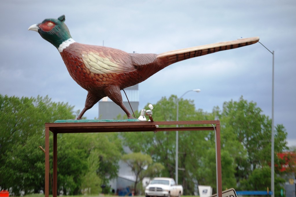 Pheasant Statue, Winner, SD[/caption]
Now, for that “Pheasant Capital” bit…. Research has shown me that Redfield, South Dakota is the “Pheasant Capital of the World” and they have even registered the phrase. Redfield is in the northeast section of South Dakota, north of Mitchell. As late as 1994 there has been a dispute between Winner and Redfield as to which is the “official” capital. I found an interesting article that shows that on October 26, 1994 Redfield had trademarked the phrase. Winner still claims it as well. But, Gregory is still the “ground-zero of pheasantdom.” I think this argument has gone to the birds!!!
[caption id="attachment_4016" align="aligncenter" width="300"]
Pheasant Statue, Winner, SD[/caption]
Now, for that “Pheasant Capital” bit…. Research has shown me that Redfield, South Dakota is the “Pheasant Capital of the World” and they have even registered the phrase. Redfield is in the northeast section of South Dakota, north of Mitchell. As late as 1994 there has been a dispute between Winner and Redfield as to which is the “official” capital. I found an interesting article that shows that on October 26, 1994 Redfield had trademarked the phrase. Winner still claims it as well. But, Gregory is still the “ground-zero of pheasantdom.” I think this argument has gone to the birds!!!
[caption id="attachment_4016" align="aligncenter" width="300"]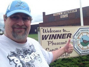 Here is the REAL Winner!![/caption]
[caption id="attachment_3902" align="aligncenter" width="300"]
Here is the REAL Winner!![/caption]
[caption id="attachment_3902" align="aligncenter" width="300"]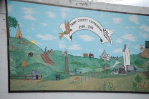 Centennial Mural for Tripp County in Winner[/caption]
[caption id="attachment_3907" align="aligncenter" width="300"]
Centennial Mural for Tripp County in Winner[/caption]
[caption id="attachment_3907" align="aligncenter" width="300"]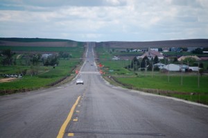 Heading west on US 18 out of Winner, South Dakota[/caption]
I continued to head further west to Mission, which would be my last stop on the Oyate Trail as I planned to head north to the Badlands from there. By the way, Mission, SD is the home of Bob Barker, famous as the host of The Price is Right. The town of Mission is in the Rosebud Indian Reservation, home of the Sicangu Lakota tribe of the Sioux Nation.
[caption id="attachment_3910" align="aligncenter" width="199"]
Heading west on US 18 out of Winner, South Dakota[/caption]
I continued to head further west to Mission, which would be my last stop on the Oyate Trail as I planned to head north to the Badlands from there. By the way, Mission, SD is the home of Bob Barker, famous as the host of The Price is Right. The town of Mission is in the Rosebud Indian Reservation, home of the Sicangu Lakota tribe of the Sioux Nation.
[caption id="attachment_3910" align="aligncenter" width="199"]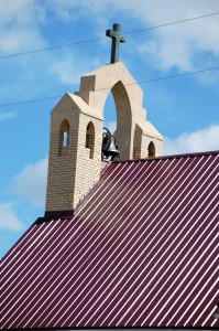 Catholic Church in Mission, SD[/caption]
[caption id="attachment_3908" align="aligncenter" width="300"]
Catholic Church in Mission, SD[/caption]
[caption id="attachment_3908" align="aligncenter" width="300"]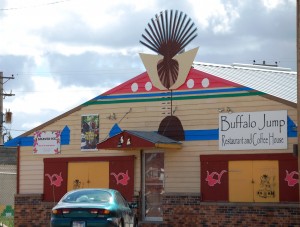 Buffalo Jump Restaurant – Mission, SD[/caption]
While driving through Mission I came across this colorful restaurant called the Buffalo Jump. It is owned and operated by Native Americans and offers buffalo burgers, Indian tacos, and, yes, Asian, Mexican, Italian, seafood and other goodies.
[caption id="attachment_3911" align="aligncenter" width="300"]
Buffalo Jump Restaurant – Mission, SD[/caption]
While driving through Mission I came across this colorful restaurant called the Buffalo Jump. It is owned and operated by Native Americans and offers buffalo burgers, Indian tacos, and, yes, Asian, Mexican, Italian, seafood and other goodies.
[caption id="attachment_3911" align="aligncenter" width="300"]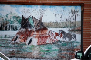 Mural in Mission, SD[/caption]
[caption id="attachment_3909" align="aligncenter" width="300"]
Mural in Mission, SD[/caption]
[caption id="attachment_3909" align="aligncenter" width="300"]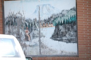 Another Mural in Mission, SD[/caption]
From Mission I headed north on US 83 until I arrived at SD 63.
[caption id="attachment_3912" align="aligncenter" width="300"]
Another Mural in Mission, SD[/caption]
From Mission I headed north on US 83 until I arrived at SD 63.
[caption id="attachment_3912" align="aligncenter" width="300"]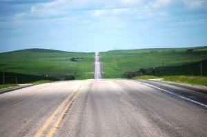 US 83 in South Dakota heading north from Mission[/caption]
I found it interesting that my GPS sent me onto SD 63. I think my GPS is learning my penchant for back roads. SD 63 is 23 miles GRAVEL ROAD that cuts mainly through the Rosebud Indian Reservation to Belvidere, SD on I-90 near Badlands National Park. What a wonderful drive it was!!
[caption id="attachment_3915" align="aligncenter" width="300"]
US 83 in South Dakota heading north from Mission[/caption]
I found it interesting that my GPS sent me onto SD 63. I think my GPS is learning my penchant for back roads. SD 63 is 23 miles GRAVEL ROAD that cuts mainly through the Rosebud Indian Reservation to Belvidere, SD on I-90 near Badlands National Park. What a wonderful drive it was!!
[caption id="attachment_3915" align="aligncenter" width="300"]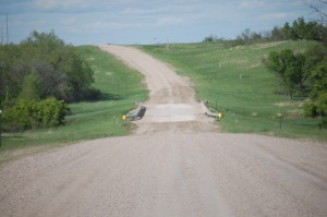 SD 63 near Norris, SD — 23 miles of gravel road[/caption]
[caption id="attachment_3916" align="aligncenter" width="199"]
SD 63 near Norris, SD — 23 miles of gravel road[/caption]
[caption id="attachment_3916" align="aligncenter" width="199"]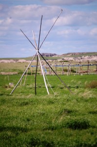 Sioux Burial Ground – I think[/caption]
[caption id="attachment_3918" align="aligncenter" width="300"]
Sioux Burial Ground – I think[/caption]
[caption id="attachment_3918" align="aligncenter" width="300"]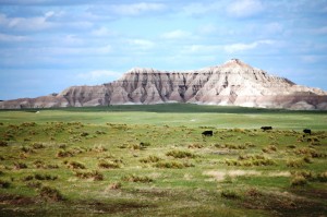 Sunlit badlands on SD 63[/caption]
[caption id="attachment_3919" align="aligncenter" width="640"]
Sunlit badlands on SD 63[/caption]
[caption id="attachment_3919" align="aligncenter" width="640"]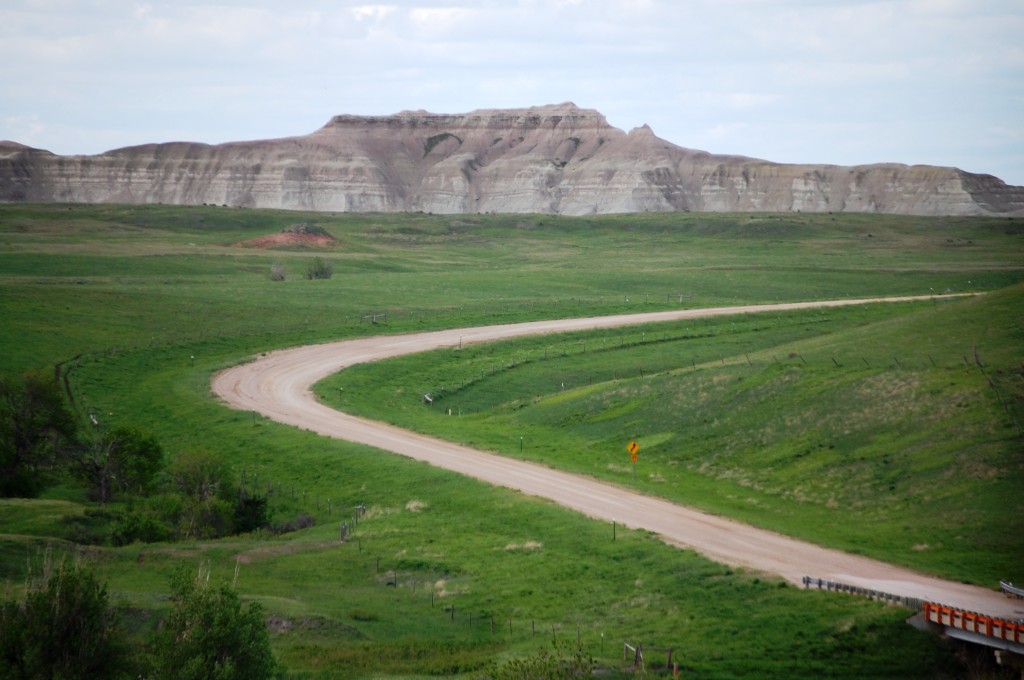 SD 63 going though prairie grasslands and badlands[/caption]
[caption id="attachment_3923" align="aligncenter" width="300"]
SD 63 going though prairie grasslands and badlands[/caption]
[caption id="attachment_3923" align="aligncenter" width="300"]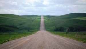 Long gravel road[/caption]
[caption id="attachment_3924" align="aligncenter" width="300"]
Long gravel road[/caption]
[caption id="attachment_3924" align="aligncenter" width="300"]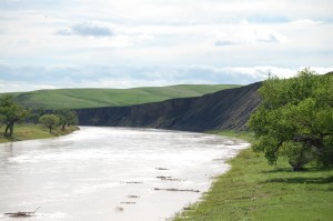 White River as seen from SD 63 south of Belvidere, South Dakota[/caption]
I crossed over the White River just south of Belvidere. The White River is the 36th longest river in the US at 506 miles. It truly is whitish gray as a result of the clay, sand and volcanic ash it picks up along the way.
[caption id="attachment_3925" align="aligncenter" width="300"]
White River as seen from SD 63 south of Belvidere, South Dakota[/caption]
I crossed over the White River just south of Belvidere. The White River is the 36th longest river in the US at 506 miles. It truly is whitish gray as a result of the clay, sand and volcanic ash it picks up along the way.
[caption id="attachment_3925" align="aligncenter" width="300"]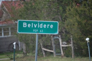 Belvidere, SD – Population 63[/caption]
I finally got back onto pavement as I entered Belvidere, just a small town with 63 people and perhaps that many horses and goats….
[caption id="attachment_3927" align="aligncenter" width="300"]
Belvidere, SD – Population 63[/caption]
I finally got back onto pavement as I entered Belvidere, just a small town with 63 people and perhaps that many horses and goats….
[caption id="attachment_3927" align="aligncenter" width="300"]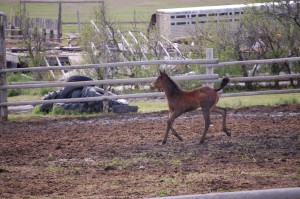 Foal jogging in Belvidere[/caption]
[caption id="attachment_3929" align="aligncenter" width="300"]
Foal jogging in Belvidere[/caption]
[caption id="attachment_3929" align="aligncenter" width="300"]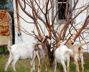 Community grazing tree in Belvidere[/caption]
[caption id="attachment_3930" align="aligncenter" width="300"]
Community grazing tree in Belvidere[/caption]
[caption id="attachment_3930" align="aligncenter" width="300"]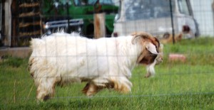 Grandpa Goat[/caption]
[caption id="attachment_3928" align="aligncenter" width="300"]
Grandpa Goat[/caption]
[caption id="attachment_3928" align="aligncenter" width="300"]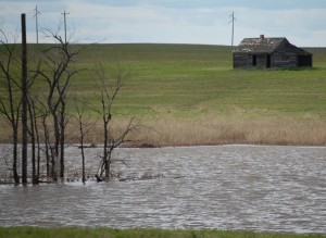 Rural Scene near Belvidere, SD[/caption]
It was time to fuel up so I stopped at the Badland’s Travel Stop in Kadoka just off of I-90 west of Belvidere. I loved the skies behind it.
[caption id="attachment_3932" align="aligncenter" width="300"]
Rural Scene near Belvidere, SD[/caption]
It was time to fuel up so I stopped at the Badland’s Travel Stop in Kadoka just off of I-90 west of Belvidere. I loved the skies behind it.
[caption id="attachment_3932" align="aligncenter" width="300"]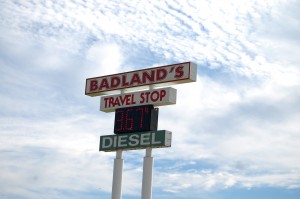 Badland’s Travel Stop – Kadoka, SD[/caption]
[caption id="attachment_3933" align="aligncenter" width="199"]
Badland’s Travel Stop – Kadoka, SD[/caption]
[caption id="attachment_3933" align="aligncenter" width="199"]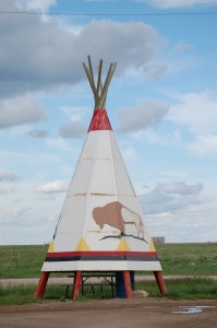 Teepee Picnic Area at Badland’s Travel Stop[/caption]
[caption id="attachment_3945" align="aligncenter" width="199"]
Teepee Picnic Area at Badland’s Travel Stop[/caption]
[caption id="attachment_3945" align="aligncenter" width="199"]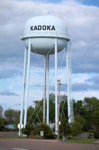 Kadoka, South Dakota water tower[/caption]
Kadoka, South Dakota is “The Gateway to the Badlands.” The name Kadoka is a Lakota word which means “Hole in the Wall,” but the town doesn’t seem that way….
[caption id="attachment_3934" align="aligncenter" width="300"]
Kadoka, South Dakota water tower[/caption]
Kadoka, South Dakota is “The Gateway to the Badlands.” The name Kadoka is a Lakota word which means “Hole in the Wall,” but the town doesn’t seem that way….
[caption id="attachment_3934" align="aligncenter" width="300"]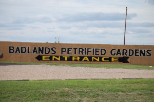 Badlands Petrified Gardens in Kadoka, SD[/caption]
[caption id="attachment_3937" align="aligncenter" width="640"]
Badlands Petrified Gardens in Kadoka, SD[/caption]
[caption id="attachment_3937" align="aligncenter" width="640"]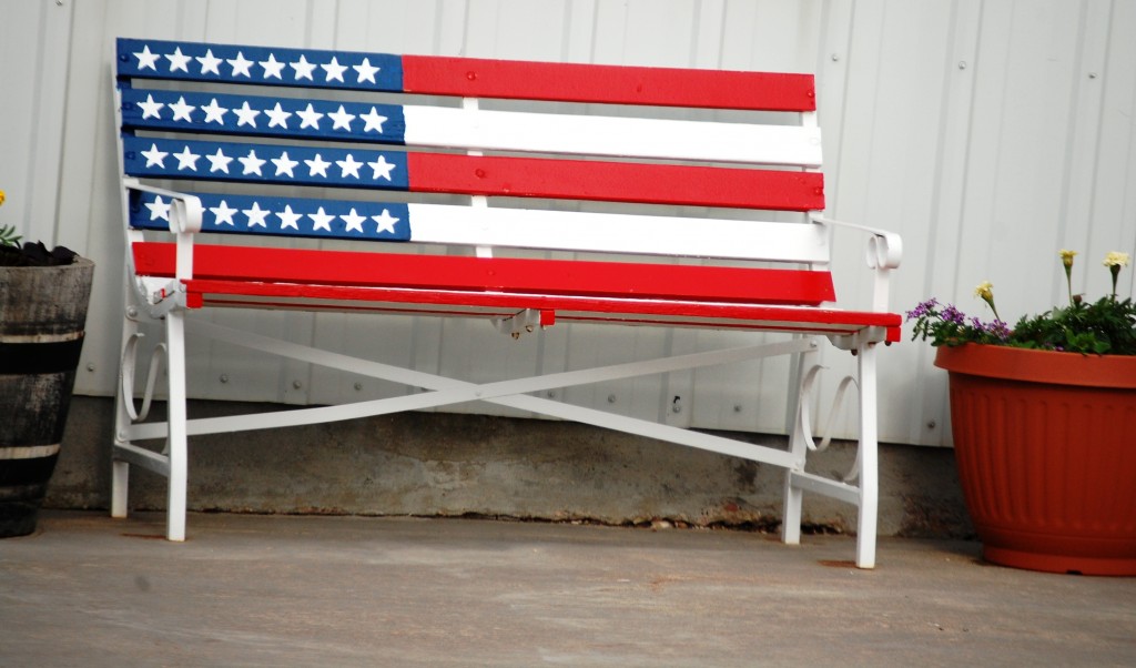 Flag Benches in Kadoka, SD[/caption]
I really got a kick out of all of the homemade signs in Kadoka…..
[caption id="attachment_3938" align="aligncenter" width="300"]
Flag Benches in Kadoka, SD[/caption]
I really got a kick out of all of the homemade signs in Kadoka…..
[caption id="attachment_3938" align="aligncenter" width="300"]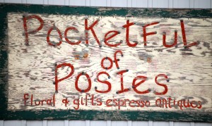 Pocketful of Posies – Kadoka, SD[/caption]
[caption id="attachment_3939" align="aligncenter" width="199"]
Pocketful of Posies – Kadoka, SD[/caption]
[caption id="attachment_3939" align="aligncenter" width="199"]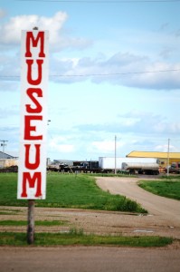 Museum – Kadoka, SD[/caption]
[caption id="attachment_3940" align="aligncenter" width="300"]
Museum – Kadoka, SD[/caption]
[caption id="attachment_3940" align="aligncenter" width="300"]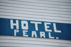 Hotel Pearl – Kadoka, SD[/caption]
And then there is the old Wagon Wheel motel sign…
[caption id="attachment_3943" align="aligncenter" width="300"]
Hotel Pearl – Kadoka, SD[/caption]
And then there is the old Wagon Wheel motel sign…
[caption id="attachment_3943" align="aligncenter" width="300"]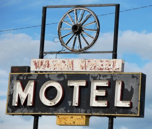 Wagon Wheel Motel – Kadoka, SD[/caption]
[caption id="attachment_3944" align="aligncenter" width="640"]
Wagon Wheel Motel – Kadoka, SD[/caption]
[caption id="attachment_3944" align="aligncenter" width="640"]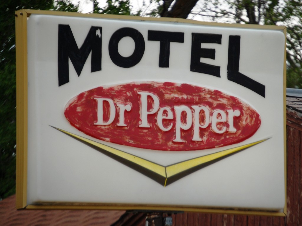 Dr. Pepper Sign in Kadoka, SD[/caption]
And that was the end of the road to the Badlands — Kadoka is the “Gateway!”
[caption id="attachment_3953" align="aligncenter" width="194"]
Dr. Pepper Sign in Kadoka, SD[/caption]
And that was the end of the road to the Badlands — Kadoka is the “Gateway!”
[caption id="attachment_3953" align="aligncenter" width="194"]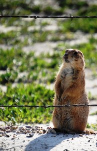 Prairie Dog — watch for me soon[/caption]
On my next post I will have some great shots of prairie dogs and badlands!!]]>
Prairie Dog — watch for me soon[/caption]
On my next post I will have some great shots of prairie dogs and badlands!!]]>